

The Land Of Israel
Israel has a total surface of 22,145 square kilometres, with a land area of 21,671 square kilometres. With a length of 470 km and a width of 135 km, this wonderful country borders Lebanon northward, the Mediterranean Sea in the west, Egypt in the southwest, Syria in the northeast, and Jordan.
In Israel, the geography varies; indeed, there are mountains, seas, lakes, forests, deserts, fertile lands and much more. And everything is pretty close compared to other big countries. You can explore the Land of Israel by car and, for example, cross its width from the Mediterranean Sea westwards to the Dead Sea eastwards in only 90 minutes drive.
Another exciting trip you could organise would begin in the farthest north point, Metulla, to end up in Eilat, the southern place of Israel, employing nine hours drive.
Regions Of Israel
Israel consists mainly of four geographical regions, the three parallel areas from north to south and a desertic area in the southern part.
The closest location to the sea is the coastal region, which stretches alongside the Mediterranean Sea. This region is made mainly of sandy seashores whose borders are close to fertile lands. More than 7 million people live in the coastal area that hosts most of the cities.
In the north area, there are sandy beaches with jagged sandstone cliffs.
The North Of Israel
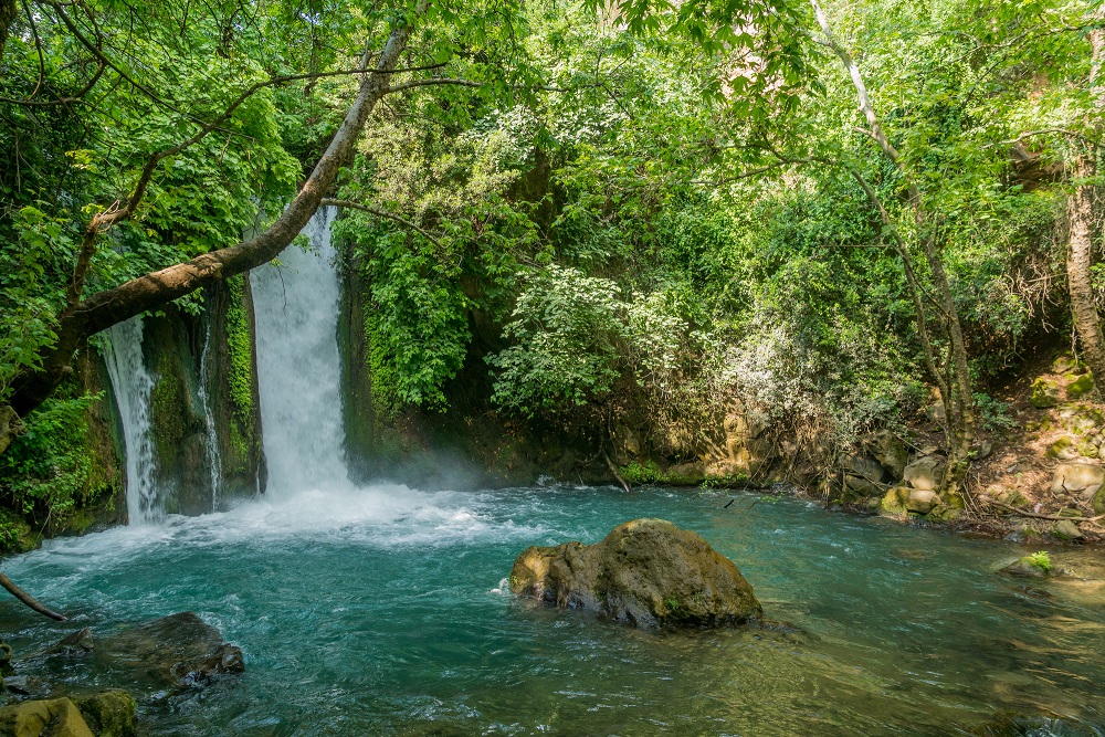
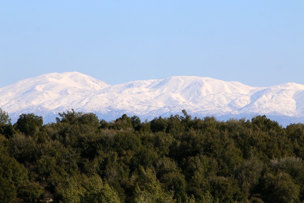
Alongside the length of Israel, there are several mountain chains. Moreover, in the northeast, the Golan Heights are made of basaltic rocks originated by volcanic eruptions and overlook the Hula Valley.
The hills of Galilee are made of dolomite and limestone, with heights that change from 500 to 1,200 m ASL. the several streams with abundant rainfalls make this region pretty green. Indeed, it is an area whose primary resources are agriculture and tourist activities.
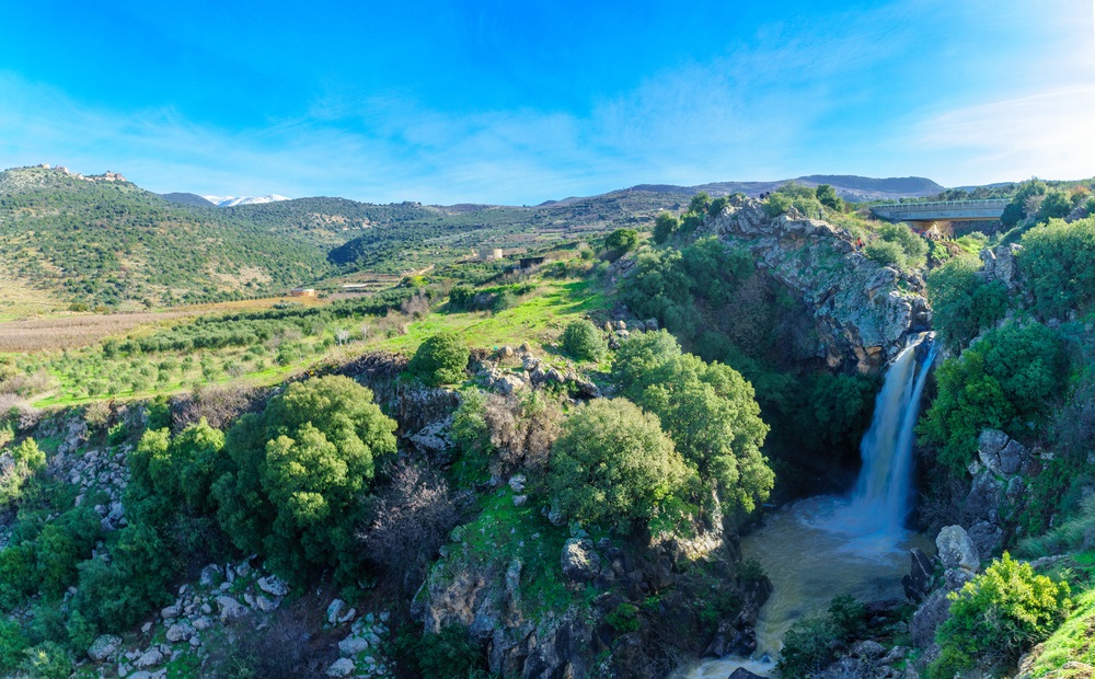
The Jezreel Valley(Emek Yizreel) is the most flourishing agricultural area in Israel, and it hosts many communities such as kibbutzim and moshavim.
Moreover, this valley separates the hills of Galilee and Samaria, where there are characteristic stony hilltops and fertile valleys with forests of old olive trees. The natural landscape blends with the terraced hillsides, which were developed in ancient times.
The Sea of Galilee – Kinneret
The Sea of Galilee is also named Lake Kinneret, and it is located between the hills of Galilee and the Golan Heights at an altitude of 212 meters below sea level, with a 21 km length and 8 km width. Being the largest lake in Israel, it serves as the country’s principal water reservoir. Lake Kinneret’s shores are notable historical and religious sites hosting agricultural communities, fisheries, and tourist facilities.

The Desert Area Of Israel
The Desert of Negev constitutes almost half of Israel’s land area, and it is mainly inhabited. The inhabitants of the desert area rely primarily on agricultural and industrial resources. In the southern part of the Negev, the land is arid, and it features sandstone hills, canyons and wadis, that produce floods in the wintertime due to the abundant rains.
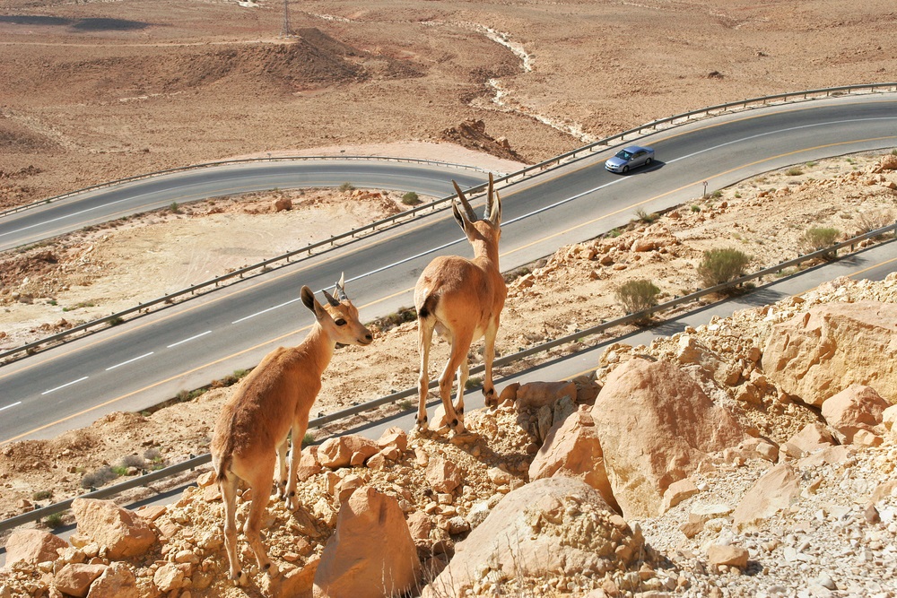
Southward, the desert presents high mountains, bare craggy peaks, craters, and rock-strewn plateaus, with a dry climate. There are three erosive cavities in these areas, the largest one is almost 35 km long, and it is deep in the earth’s crust, displaying beautiful colours because of the several rock sorts.
Close to the city of Eilat on the Red Sea, there are sharp crests made of granite forming dry gorges and sheer cliffs, with colourful sandstones which glow in the sunlight.
Arava a unique region in Israel
Another exciting and unique region in Israel is the Arava, Israel’s savannah region, beginning in the Dead Sea’s southern area and extending up to the Gulf of Eilat, Israel’s outflow into the Red Sea. In the Arava, with sophisticated farming techniques combined with climatic conditions, out-of-season fruit and vegetables are cultivated and exported. The Gulf of Eilat is well-known because of its blue waters, coral reefs and exotic marine life, and it lies at the southern tip of the Arava.
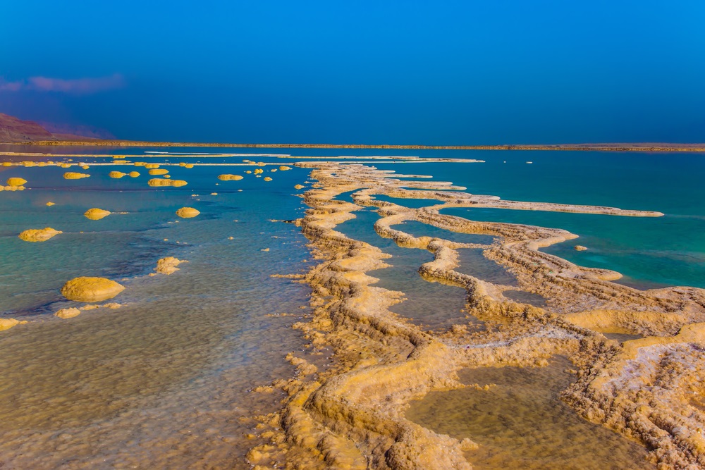
The Dead Sea
On the southern edge of the Jordan Valley, the Dead Sea is the lowest point on earth, being almost 400 m below sea level and, its salinity and density are at the highest level. The Dead Sea has waters that are rich in potash, magnesium and bromine, and the table and industrial salts. Since 1960, the Dead Sea’s surface level has dropped some 10.6 m. A plan to connect the Dead Sea with the Mediterranean Sea through a pipe system should help to restore the Dead Sea natural level.
The Jordan Valley the eastward part of Israel
The Jordan Valley and the Arava are in the eastward part of Israel, and they are part of the Syrian-African Rift, which is a split in the earth’s crust dating back millions of years ago.
The Jordan River flows through the Rift from north to south, descending over 700 meters in its 300 km route. Streams from Mount Hermon feed the river. It runs over the luxuriant Hula Valley ending up into Lake Kinneret and winding through the Jordan Valley before ending up into the Dead Sea.
Weather
Israel has both temperate and tropical weather, with an abundance of sunshine. There is a rainy winter period from November to May, and through the next six months, there is a dry summer season. Rainfalls are almost intense in the north and centre of Israel in winter time, while in the northern Negev and the southern areas, rains are pretty scarce.